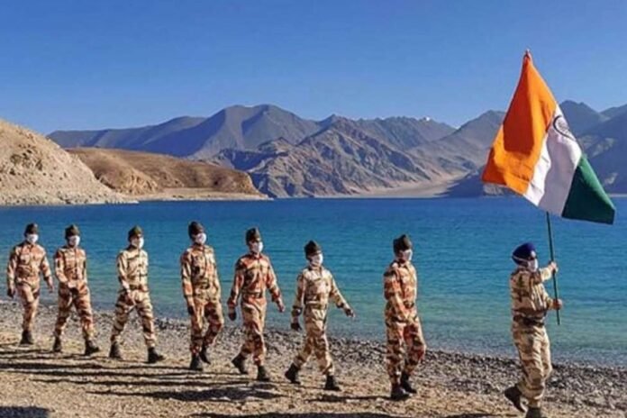
Ladakh Standoff: China looks to have finished building a bridge across the Pangong Tso in Ladakh based on the most recent satellite photographs. It might soon be employed in the event of a conflict with India on the Line of Actual Control (LAC) to transport military personnel and supplies.
China’s side of the Line of Actual Control (LAC) is where two thirds of it is located. There have been conflicts between Indian and Chinese troops there since 2017. China constructed a new division-level headquarters and garrison in the area to support its forces stationed at the lake as hostilities between the two nations simmered. The headquarters were constructed above the encampments that emerged during the 2020 conflict, on land that India had claimed.
The two nuclear-armed nations are divided by the land-area continuum, or LAC both in Ladakh and in the eastern sector. Pangong Tso traverses across water in this instance. Nonetheless, the Chinese and Indian sides have overlapping claims.
During the Doklam standoff, Pangong Tso Lake in eastern Ladakh gained attention when a video of an altercation between Indian and Chinese soldiers on its banks went viral on August 19, 2017. The video showed the soldiers punching and kicking each other, throwing stones, and using sticks and steel rods, all of which resulted in serious injuries. It was a forerunner to the two nations’ 2020 Galwan conflict, which claimed lives on both sides.
In May 2020, Chinese military established a camp at the location, which was later replaced in June 2020 with a more permanent structure. The majority of 2021 was then spent by this new institution developing and growing. Recent satellite photography of the area revealed that competition is getting closer for the new Pangong Tso bridge. The narrowest section of the lake, Khurnak, is where the bridge is being constructed.
Expert in satellite photography Damien Symon wrote on X: “Pangong Tso imagery reveals the new bridge is almost finished, with its surface recently asphalted (blacktopped).” By facilitating quicker access to battle zones and Indian positions surrounding the lake, the bridge enhances the mobility of Chinese forces in the area.
India used a cunning deployment in 2020 to seize control of the Pangong Tso’s southern banks. On the evening of August 29, specialized forces from the Indian Army were brought in to outflank the People’s Liberation Army (PLA) of China. They took control of at least four positions near the Pangong Tso’s southern bank that were claimed by both sides. In the event that China has to quickly access these Indian-dominated areas, the new bridge will be helpful.
In a 2022 assessment, the Center for Strategic and International Studies recommended extensive infrastructure development i Ladakh, including a sizable PLA presence. The headquarters and support buildings are located in the middle, and a variety of trenches and revetments for equipment storage and security surround them on all sides.
Many bunkers with huge numbers of weapon, probably anti-aircraft and artillery, are located on the south side.
The China Power project’s assessment stated, “The northern section shows a full company of armored personnel carriers (APCs), as well as vehicle shelters and additional weapons positions.”
As “a new node connecting troops at the lake with military authorities elsewhere in the PLA Western Theater Command, headquartered thousands of kilometers away,” the headquarters close to Pangong Tso will function.
The complex has a vast arsenal of weapons and equipment that might come in handy in a future skirmish or war with India. The facility’s howitzers and air defense weapons might be used to retain or advance PLA positions, and the APCs and other vehicles stationed there could rush troops to strategic points along the lake, the report claims.
Also Read: Have India, China started resolving strained ties?
India, China tussle over Pangong Tso in Ladakh
Pangong Tso is a 14,000-foot-high lake that is long, narrow, and deep. The lake’s broadest point is 6 kilometers wide and around 135 kilometers long. In the winter, the lake freezes and is used for ice hockey and skating.
Before invading Tibet in the 19th century, the fabled Dogra general Zorawar Singh is supposed to have trained his army and horses on the frozen Pangong Lake. This narrative inspired the naming of India’s indigenous Zorawar Light tank, which would also be stationed in this inhospitable region.
The Pangong Tso is situated in the way of China’s primary offensive route into Indian-held territory, the Chushul approach. China carried out its military offensive against India in the 1962 conflict through this route.
China constructed a 5-kilometer road within Indian territory along the lake’s shore in 1999 after the Indian Army relocated its forces from this area to participate in operations against invaders from Pakistan in the Kargil region.
The G219 Karakoram Highway is connected to the 1999 road, which is an addition to the vast network of highways constructed in the region by the Chinese. The Chinese military was able to get a glimpse of the Indian position on the northern side of the Pangong Tso thanks to one of these routes.


